 City Surface - [source code]
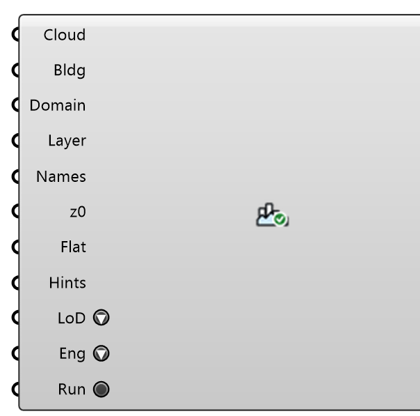
Build ONE watertight surface of terrain, buildings (LoD 1.2 boxes to LoD 2.2 roofs) and surface layers (water, roads, green) for urban CFD. Ground comes from points (wired, or class 2 of a LAS/XYZ cloud) and every footprint and layer outline is carried into its triangulation, so buildings stand IN the terrain with walls down to the ground on every side instead of boxes sunk through a plate. A roof is the footprint's Height above its median ground, or else the Roof Percentile of the roof points (class 6) inside it, or — with neither, typically a house the survey saw only as the tree canopy over it — a flat box at the median height of its five nearest reconstructed buildings (the Report counts them). Overlapping footprints are separated (the earlier one wins); flattened layers sit at one level. Outputs are split by part so each can be its own patch. Method: Pađen et al. (2022), Frontiers in Built Environment 8:899332, doi:10.3389/fbuil.2022.899332; Biljecki et al. (2016), Computers, Environment and Urban Systems 59, 25-37, doi:10.1016/j.compenvurbsys.2016.04.005.
Input
| Name | Nickname | Description | Type |
|---|---|---|---|
| Point Cloud | Cloud | LAS, LAZ or text x y z [class] files. Class 2 is read as ground, class 6 as roof; a file without classes is all ground. Only points inside the Domain are kept. LiDAR Site's Point Cloud output. | Text |
| Footprints | Bldg | Closed building footprints (plan view; z is ignored). LiDAR Site's Footprints output. | Curve |
| Domain | Closed planar outline of the area to build (plan view). Everything is clipped to it. LiDAR Site's Domain output. | Curve | |
| Layer Outlines | Layer | Closed outlines of surface layers imprinted into the terrain (water, roads, green...). LiDAR Site's Layer Outlines output. | Curve |
| Layer Names | Names | Name per layer outline (by index, the last repeats). Outlines with the same name form one output. LiDAR Site's Layer Names output. | Text |
| Layer Roughness | z0 | Aerodynamic roughness length z0 [m] per layer outline (by index, the last repeats), carried to the Layer Roughness output — one value per Layers mesh, for Ground Roughness. LiDAR Site's Layer Roughness output. | Number |
| Flatten | Flat | Per layer outline (the last repeats): set it to one level, the Layer Percentile of the ground under it (water). An outline whose ground falls more than 2 m across it (a river mapped as an area) follows the ground instead. LiDAR Site's Flatten output. | Boolean |
| Roof Hints | Hints | Optional roof hints per footprint, aligned with Footprints (LiDAR Site's Roof Hints): 'gable;4;90;across' — shape (flat/gable/hip/shed or an OSM roof:shape word); roof height m; ridge direction °; 'across' for the ridge on the short side. A hint is used only where the LiDAR has too few roof points to fit a roof; a fit always wins, and a fit that disagrees with its hint is counted in the Report. | Text |
| LoD | Roof detail. LoD 1.2: one flat roof per footprint (Roof Percentile of its points). LoD 1.3: one flat roof per height level (a tower on a podium is two; a pitched roof stays one). LoD 2.0: ONE standard roof per building — flat, shed, gable or hip, whichever fits its roof points best (flat when within 15 %) — on the footprint's oriented box, clipped to the footprint: the cleanest choice where the LiDAR is sparse or trees overhang. LoD 2.1: roof planes like 2.2, but details from 4 m only: smaller parts are merged (unless they stand 4 m above their neighbours — a shaft is not a detail), and a pitched plane whose points are thinner than 3 m on the map (a wall, an eave line) is dropped. LoD 2.2: roof planes fitted to the roof points (pitched roofs, ridges, steps between levels), details from 2 m. At every 2.x level a footprint with a Height, or without enough points for a plane, stays LoD 1.2. | Text | |
| Engine | Eng | Who thins the ground raster and scores the roof planes. Auto: the OpenCL GPU when there is one, else the CPU. GPU: the OpenCL GPU; a fallback to the CPU is reported, never silent. CPU: every core. The surface is the same either way — the GPU reproduces the CPU's cell means, medians and plane choices; the sequential triangulation stays on the CPU. | Text |
| Run | Build the surface. Resets when the run starts; a wired toggle held true re-runs when the inputs change. | Boolean |
Output
| Name | Nickname | Description | Type |
|---|---|---|---|
| Terrain | The ground outside buildings and layers (open at the domain outline). | Mesh | |
| Buildings | Bldg | Roofs and every wall, down to the ground and between buildings. | Mesh |
| Layers | Layer | One mesh per layer name. | Mesh |
| Layer Names | Names | The name of each Layers mesh. | Text |
| Surface | All of it as one welded mesh. | Mesh | |
| Roof Heights | RoofZ | Roof elevation per footprint (by index); NaN where a footprint was skipped. | Number |
| Report | What was built, skipped and approximated. | Text | |
| Layer Roughness | z0 | z0 [m] of each Layers mesh (by index, the first Layer Roughness given for its name; none given: nothing). With Layers and Layer Names, the Faces, Roughness Lengths and Names of Ground Roughness. | Number |
| Tree Crowns | Crowns | Tree crowns from the cloud's own vegetation returns (classes 3-5; unclassified points beside buildings when the cloud has a building class), one closed mesh per cluster of 4 m columns from 0.41 x tree height to the top, none inside a footprint, none under 2 m. Plug into the Tree component's Geometry, one Tree per crown. Empty when the cloud has no vegetation (the Report says why); kept with the cached surface. | Mesh |
| Low Vegetation | Low | The vegetation the crowns leave out — hedges, shrubs, young trees from 0.5 m up — one closed mesh per cluster of 2 m columns that stand on the ground and rise to the tallest return, none under a crown, none inside a footprint. Plug into the Tree component's Geometry with a shrub species (Hedge / shrub) - one zone per mesh there, and a site has hundreds of these (the Report counts them); Outdoor+ Vegetation Region takes them as one region. Read only from a cloud that classifies vegetation (ASPRS 3-5): where the trees are unclassified points beside buildings, a low one would also be a car or a fence, so none is read. Not here: lawn under 0.5 m (the surface layers' ground cover) and what stands inside a tree's 4 m crown cell (the trunk space - the Report counts it). With Tree Crowns these are the trees, and the hedges and shrubs outside their cells; the Report says what was read and what was not. | Mesh |
| Trees | The same vegetation as individual trees, ONE mesh: a round crown on a short trunk each, standing where the canopy of the cloud's vegetation returns peaks (1 m raster, 3 m and taller, none inside a footprint, at most the 20,000 tallest). For looking at and for a render, not for a solver: Tree Crowns are the porous zones the Tree component takes. Empty when the cloud has no vegetation (the Report says why); kept with the cached surface. | Mesh | |
| Full Terrain | Ground | The WHOLE ground as one welded mesh over the whole Domain: no layer is cut out of it and no footprint is either. It is the surface's own triangulation with every triangle at the height of the ground at its corners, so where Terrain or a Layers mesh exists the two agree exactly, a flattened pond is as level here as there, and under a building it is the plane through the ground the walls stand on at the footprint's corners (not the roof). Terrain stays the ground OUTSIDE buildings and layers; this is the ground they all stand on, to look at, to drape something on or to read heights from. Not drawn in this component's preview (it lies under the other parts); kept with the cached surface. | Mesh |
| Bridges | The bridge decks as closed slabs, from the cloud's bridge returns (ASPRS class 17): one plane through the returns, sides smoothed, 1 m thick, wherever the ground is more than 2 m under the deck (where it comes up to the deck, the bridge rests on it and Terrain has it). Not part of Surface, which is 2.5D and cannot pass under anything; Site Look's Bridges. Empty when the cloud has no bridge class; kept with the cached surface. | Mesh |