 LiDAR Site - [source code]
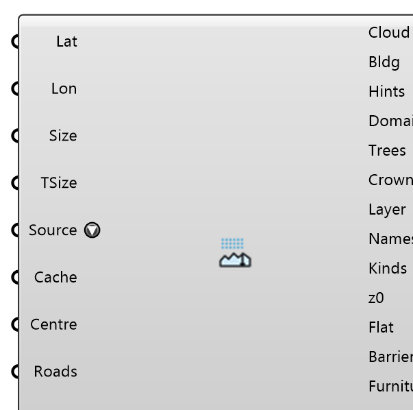
Fetch open LiDAR and building footprints for a site from its latitude and longitude, for City Surface: the footprints over a square of the given Size, the point cloud (the terrain) over a larger square, Terrain Size — the ground a CFD domain stands on reaches further than the buildings that matter. The Netherlands: AHN (Het Waterschapshuis, CC-BY 4.0) from its official sheets — a sheet is ~5 GB and is downloaded once into the cache, then every site in it is read from there — with BAG footprints (Kadaster, CC0). The United States: USGS 3DEP (public domain), only the point-cloud nodes over the site, with GlobalBuildingAtlas footprints (TUM, CC BY-NC 4.0; OpenStreetMap if it cannot be read). France (IGN LiDAR HD, Licence Ouverte), Switzerland (swissSURFACE3D, swisstopo), Bavaria (CC BY 4.0), Scotland (National LiDAR Programme, OGL), Estonia (Maa- ja Ruumiamet), Denmark (Danmarks Højdemodel), Spain (PNOA 2022-25: Aragon, Extremadura, the Canaries) and Slovenia (GURS CLSS), the last three from the open-lidar-data mirror: the 1 km tiles over the site, 65-250 MB each (Slovenia's 2024 flight up to 1 GB), cached once, with the same footprints. Everything comes out in metres around the site centre: wire Point Cloud, Footprints and Domain into City Surface. Tree Crowns are read from the cloud's own vegetation returns (one closed mesh per cluster, for the Tree component); Trees, Barriers and Furniture are for looking at and for a render (round trees; with Roads on, OpenStreetMap fences, walls, hedges and street furniture); Layer Outlines, Layer Names, Layer Roughness and Flatten are OpenStreetMap land cover (ODbL) with its Davenport z0, in the footprints' frame — wire them into the City Surface inputs of the same names. Rivers, streams and canals mapped as lines come with them as water ribbons (the OpenStreetMap width tag, else river 20 m, canal 8 m, stream 3 m).
Input
| Name | Nickname | Description | Type |
|---|---|---|---|
| Latitude | Lat | Site centre latitude (WGS84, degrees). | Number |
| Longitude | Lon | Site centre longitude (WGS84, degrees). | Number |
| Size | Edge of the square the building footprints cover [m]. | Number | |
| Terrain Size | TSize | Edge of the square the point cloud — the terrain — and the Domain cover [m]: make it cover the whole CFD domain floor. At least Size. Optional; 0 or unset = 2 x Size. | Number |
| Source | Where the LiDAR comes from. Auto: AHN inside the Netherlands, swissSURFACE3D, Bavaria, IGN LiDAR HD, Scotland's National LiDAR Programme, Estonia, Denmark, Slovenia, Saxony, Luxembourg, Brussels, Navarra or Spain's PNOA where the site lies in one, else USGS 3DEP (its newest project over the site). Browse… picks one dataset: "3DEP | Text | |
| Cache Folder | Cache | Where downloads are kept (default Eddy3D/LidarCache in the local app data folder: ~/Library/Application Support on macOS, %LOCALAPPDATA% on Windows). An AHN sheet is ~5 GB. | Text |
| Cloud Centre | Centre | URL or local file source only: the site centre in the FILE's coordinates (metres — UTM, a national grid), i.e. where Latitude/Longitude lie in the file. Points are returned relative to it. | Point |
| Roads | Also fetch OpenStreetMap roads, paved surfaces and footpaths (highway centrelines buffered by their width or lane count, area:highway, car parks, paved plazas; footways and sidewalks, paths, cycleways and steps, 1.5-2.5 m where untagged) as three more Layer Outlines layers, 'roads', 'paved' and 'paths', that City Surface carries as their own triangle groups following the terrain. A path loses the ground a road or a paved area holds. Also one more query for the street's own objects — fences, walls and hedges (Barriers), benches, bus stops, hydrants and picnic tables (Furniture) — as simple solids on the ground. | Boolean | |
| Ring Size | Ring | Edge of a larger square [m] filled with GEDTM30 ground (OpenGeoHub, 30 m, CC BY 4.0) outside the LiDAR terrain square, so the CFD domain floor can reach further than the tiles: the offset between the two models is measured at the seam (median over a band just inside the LiDAR edge) and the join is blended over that band. The Domain becomes this square. Must be larger than Terrain Size, at most 20000 m. Optional; 0 or unset = no ring. | Number |
| Run | Fetch. Resets when the run starts; a wired toggle held true re-runs when the inputs change. | Boolean |
Output
| Name | Nickname | Description | Type |
|---|---|---|---|
| Point Cloud | Cloud | The site's points as a LAS file in local metres: City Surface's Point Cloud. | Text |
| Footprints | Bldg | Building footprints in local metres: City Surface's Footprints. | Curve |
| Roof Hints | Hints | OpenStreetMap roof hints per footprint, aligned with Footprints — 'gable;4;90;across' (shape; roof height m; direction °; across), empty when untagged: City Surface's Roof Hints. Used only where the LiDAR has too few roof points to fit a roof. | Text |
| Domain | The terrain square (Terrain Size, or Ring Size when a ring is on): City Surface's Domain. | Curve | |
| Trees | The trees as individual round crowns on short trunks, ONE mesh over Terrain Size: from the cloud's own vegetation returns where it classifies any, else from the satellite canopy map (Meta/WRI CHM v2, 1 m, CC BY 4.0; most 3DEP projects classify none). 3 m and taller, none inside a footprint, at most the 20,000 tallest. For looking at and for a render, not a solver: Tree Crowns are the porous zones the Tree component takes. The Report says where they came from. | Mesh | |
| Tree Crowns | Crowns | Tree crowns from the cloud's own vegetation returns (classes 3-5; AHN's unclassified points beside its buildings), one closed mesh per cluster of 4 m columns from 0.41 x tree height to the top, none inside a footprint, over Size — the satellite canopy rules Site Context uses. Plug into the Tree component's Geometry, one Tree per crown. | Mesh |
| Layer Outlines | Layer | OpenStreetMap land-cover outlines over Terrain Size (water, grass, forest, built-up…), in the footprints' frame, smallest first so a pond in a park keeps its own class. City Surface's Layer Outlines. | Curve |
| Layer Names | Names | The Davenport class of each Layer Outlines curve (water, smooth, open, roughly_open, rough, very_rough, closed): City Surface's Layer Names. | Text |
| Layer Kinds | Kinds | What the ground of each Layer Outlines curve IS: water, sand, rock, grass, park, pitch, scrub, farmland, orchard, bare_soil, residential, industrial, forest, garden, and roads, paved, paths. Every kind lies inside one Davenport class, so Layer Roughness stays right for it. Wire it to the Layer Names input of City Surface INSTEAD of Layer Names to split and colour its layers by what the ground is rather than by roughness class (a result saved before this output holds the class names). | Text |
| Layer Roughness | z0 | Aerodynamic roughness length z0 [m] of each Layer Outlines curve (Davenport-Wieringa): City Surface's Layer Roughness. | Number |
| Flatten | Flat | True for a lake or pond: City Surface's Flatten, so it is one level. River and stream ribbons are false, they follow the ground. | Boolean |
| Barriers | Fences, walls, retaining walls, hedges and city walls (OpenStreetMap barrier=*, ODbL) as ONE mesh of thin boxes, one per 2 m of line, standing on the ground under them at the height tagged or the kind's usual one. Needs Roads on. Over Terrain Size; the 20,000 boxes nearest the centre at most. For looking at and for a render, not a solver. The Report says what was found. | Mesh | |
| Furniture | Benches, bus stops, hydrants and picnic tables (OpenStreetMap, ODbL) as ONE mesh of a few boxes each, standing on the ground. Needs Roads on. Axis-aligned (OpenStreetMap gives a node no heading); the 5,000 nearest the centre at most. For looking at and for a render, not a solver. | Mesh | |
| Frame | How local metres relate to the world (RD New minus the centre, or the Eddy3D site frame). | Text | |
| Report | Sources (with licences), counts and notes. | Text | |
| Origin | Which dataset each layer came from (layer, features, dataset with licence): wire it into Site Report's Results for the Origin table. | Generic Data |